Melting Glaciers Create Uncertain Future for Xinjiang
2018-03-30
In a study published last month in Elsevier’s Science of the Total Environment, five Chinese researchers assessed the severity of drought in Xinjiang, China, from 1961 to 2015, and the future impact of melting glaciers on the drought conditions. The largest province in China, Xinjang is characterized by its arid climate. The area, located in the heart of Central Asia and surrounded by the Tianshan and Kunlun mountain ranges, is cut off from moist air masses. As a result, the region experienced 26 severe droughts between 1961 and 2000, with annual mean precipitation of only 158 mm.

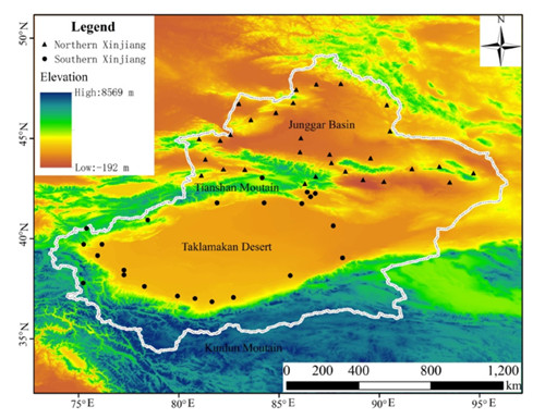
Topography of Xinjiang Region (Source: Chen et al.)
The Xinjiang region relies on its eight rivers derived from glacier melt as water sources. According to the author, there are approximately 6,500 glaciers spanning 10,500 square kilometers in North Xinjiang and 11,000 glaciers across 13,500 square kilometers in the south. Glaciers and their meltwater play a huge role in Xinjiang’s water supply, making the area extremely vulnerable to climate change.
GlacierHub spoke with Yaning Chen, one of the lead authors who is based in Xinjiang at the Institute of Ecology and Geography. He explained that millions of people in Xinjiang depend on water from mountain precipitation and glacial melt-water. “Climate change has led to high uncertainty regarding the advances and retreats of glaciers and snow cover,” he said. Glaciers could grow in some areas while shrink in others, which means that future water availability under climate change is unclear, he added.
To the average person, droughts are commonly perceived as a deficiency of precipitation over an extended period of time, resulting in water shortage. However, droughts can be further classified into specific categories for operational purposes and to aid in the study of drought conditions. These categories provide more detail on when droughts began, how long they last and their severity. Some common categories are meteorological droughts, which look at the changes in climatic conditions that led to a stark decrease in rainfall; agricultural droughts, which focus on soil moisture levels to evaluate agriculture impacts; and hydrological droughts, which use discharge in water bodies as an indicator of water availability.

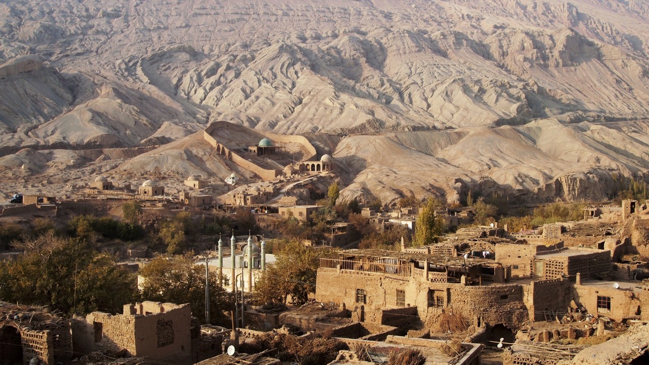
A Settlement in the Taklamakan Desert in Southern Xinjiang (Source: Kasidah/Pinterest).
Using climate observation data from meteorological stations located throughout Xinjiang, coupled with soil moisture data and annual runoff data for the eight rivers, Chen’s team created a model to evaluate the changing severity in these three types of droughts.
Based on the Standardized Precipitation Evapotranspiration Index (SPEI), a common index used to monitor meteorological drought severity globally, the researchers noted a slight drying trend since 1996, especially in southern Xinjiang. Surprisingly, Xinjiang experienced its most humid decade on record from the year 2000, coupled with a significant increase in annual air temperatures.
Increasing temperatures have enhanced moisture storage in the atmosphere, reducing the frequency and magnitude of rainfall events, the authors explained. Thus, even with more glacier melt, it might not translate to more surface water availability. This is because even if one source of water from glaciers is increasing, the atmospheric source of water from storms is decreasing. With these two sources possibly acting in opposite directions in the hydrological system, their particular balance influences the surface water supply in the region. Hence, river runoffs in four out of the eight basins are decreasing, but there are two rivers that experienced an increase.

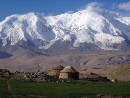
A small settlement near the Kunlun Mountains and its glaciers (Source: Carlike/Pinterest).
The analysis of hydrological drought is complex, Junqiang Yao, another author of the paper from Chengdu University of Information Technology, told GlacierHub. “Glacial melt-water is one of the most important water supplies. Drought has significant effects on water supplies through climate-driven changes in glacier-fed runoff regimes,” he said. As the paper evidences, although nearly all the glaciers in the Tianshan mountain ranges have experienced retreat, the glaciers of the Kunlun Mountains appear stable or even gaining mass as summer temperatures have decreased over the past two decades. Hence, the decreasing discharge in some rivers supplied by the Kunlun Mountains glaciers could also be due to a decrease in meltwater too.
Enhanced soil moisture loss was also evident up to 50 cm in soil depth, as increased evaporation rates also increase, signaling the potential for worse agriculture droughts.
To Chen and Yao, the effects of climate change are highly complex and uncertain, calling for further studies. Chen added that aggravated drought conditions change regional water balance and affect ecology-social economy development in Xinjiang, posing challenges for future sustainability. After all, water is a key factor restricting socio-economic development and affects ecological security in Xinjiang.
“The influence of aggravated drought on water systems and water resource security is the greatest challenge faced in Xinjiang,” he said. “Thus, it is necessary to strengthen research on the ability of the ecology-social economy system to adapt to drought, and to propose adaptive control countermeasures and dynamic models in response to climate change to guarantee water resource and ecological security.”


