


Tarim River Ecological and Hydrological Monitoring Research Station
Origin of the station
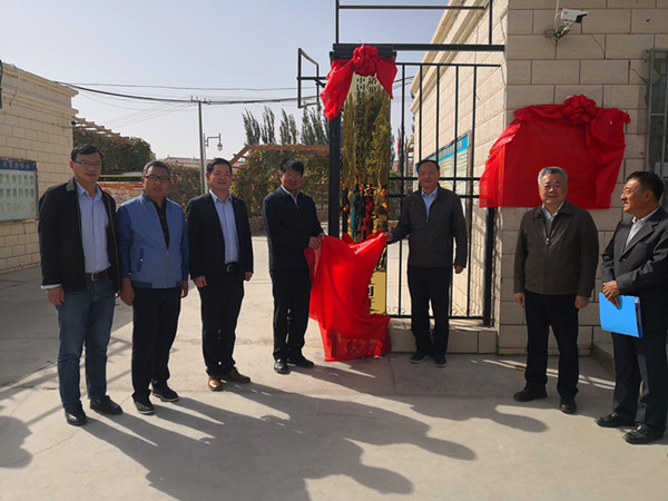
In order to scientifically and reasonably give play to the scientific research advantages of Xinjiang Institute of Ecology and Geography and the platform advantages of Tarim River Basin Trunk Stream Administration Bureau, further strengthen the Tarim River ecological hydrology monitoring research, jointly provide strong scientific research support for the comprehensive management of the Tarim River basin, after consulting with the Tarim River Basin Trunk Stream Administration Bureau, the Daxihaizi Management Station (located beside the national Highway 218 of The 34th Regiment) under the administration of Tarim River Basin Trunk Stream Administration Bureau was jointly built into the Tarim River Ecological and Hydrological Monitoring Research Station in October 2019.
Basic overview
Tarim River Ecological and Hydrological Monitoring Research Station is located in Yuli County, Mongolian Autonomous Prefecture of Bayingolin, Xinjiang province, 34 Regiment of Tarim reclamation area, 2nd division. The research station covers an area of 9828.81㎡. The greening land area is 4779.32㎡ and the building land area is 766.63㎡. The houses are mainly divided into 8 dormitories, 4 offices, 2 storerooms, 1 public toilet, 1 duty room, 1 conference room, 1 photovoltaic room, 1 dining room and 1 kitchen. The downstream of the Tarim River, where the research station is located, is adjacent to the Taklimakan Desert, with high temperature and little rainfall, with annual precipitation of 17.4~ 42.0mm, annual evaporative power of up to 2500 ~ 3000mm, and the annual cumulative temperature ≥10 ℃ was 4100 ~ 4300 ℃. It is one of the driest areas in China, and vegetation growth is almost entirely dependent on groundwater recharge. The monitoring research area of the research station is the Tarim River. The Tarim River is the longest inland river in China with a total length of 1321km. Since it is far away from the sea and located in the hinterland of the Eurasian continent, there is little precipitation. It is a continental arid desert climate zone where the average annual precipitation is only 20 mm in many years while the annual average evaporation is as high as 2500 ~ 3000 mm. Tarim River is a pure dissipative inland river, and its runoff is mainly supplied by source stream. Since the 1950s, excessive development and utilization of water and soil resources has led to the complete closure of the downstream channel from 1972 and the large-scale decline and even death of the populus diversifolia in the desert riverbank. In order to restore the damaged ecosystem in the downstream of the Tarim River, the Chinese government invested 10.7 billion yuan to implement the ecological water transporting project in 2000, which restored the integrity of the hydrological process of the downstream of the Tarim River and resulted in positive physiological and ecological response of the natural vegetation. Discontinuous flow of the Tarim river and ecological water transporting, therefore, the two big abrupt environment events, not only make it become one of the most significant areas of ecosystem damage caused by human disturbance, but also is a worldwide through ecological water transporting promoting ecological restoration rare and typical cases, which is a natural testing field for the study of ecological and hydrological problems in arid watershed.
Function positioning of the research station
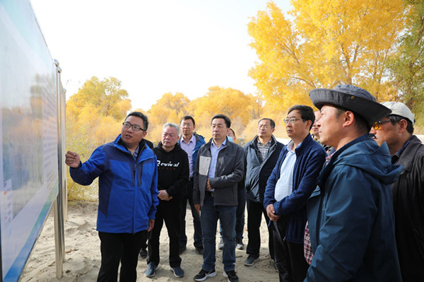
(1)Establishment of Tarim River ecological monitoring and research platform. Based on the Tarim River and centering on the restoration and protection of degraded ecosystems, an observation platform is established to study the feedback effect and adaptation mechanism of plant individuals and communities on hydrological processes, the typical ecosystem ecology-hydrological processes coupling, and the ecological protection and model of water supply restoration.
(2)Establishment of a research team for Tarim River ecological and hydrological monitoring. Taking Tarim River Ecological and Hydrological Monitoring Research Station as the platform and focusing on the ecology-hydrological processes coupling and ecological restoration, a monitoring and research team with more influence in arid areas is established by gathering personnel from The Chinese Academy of Sciences, Tarim River Basin Trunk Stream Administration Bureau, universities and military units along Tarim River.
(3)Establishment of Tarim River Popular Science Education Base. In response to the new demand of current popular science activities, it actively relies on the resource advantages of Xinjiang Institute of Ecology and Geography Chinese Academy of Sciences and Tarim River Basin trunk Stream Management Bureau to carry out popular science activities centering on the ecological environment protection of Tarim River and promote the construction of water ecological civilization of Tarim River.
(4)Promotion of the coordinated development of Tarim River water-ecology-economic society. It accelerates the transformation and application of relevant scientific and technological achievements of the Tarim River, putting forward major advisory opinions and major strategies/plans/reports to promote the coordinated development of the Tarim River water-ecology-economic society development, and consolidate and expand the results of comprehensive treatment of the Tarim River.
Contact:
Director: Ling HongBo
- Appendix
-