


New Achievements Made in Monitoring of Leaf Area Index(LAI) of Pergola-trained Vineyards in Turpan
2023-11-27
The Accurate Digital Surface Model and Landscape Research Team at the Xinjiang Institute of Ecology and Geography (XIEG), Chinese Academy of Sciences (CAS), has made significant strides in monitoring the Leaf Area Index (LAI) of Turpan's grapevines. Turpan's grapes are renowned for their exceptional sweetness and have emerged as a crucial economic driver, contributing to poverty alleviation and rural revitalization with an impressive output value of 3.31 billion yuan in 2019.
Farmers in Turpan have traditionally used manual pruning methods to adjust the LAI, which enhances both yield and quality. However, monitoring LAI in extensive vineyard fields has proven challenging, necessitating substantial manpower and time. Addressing this issue, the research team, led by corresponding author professor Alishir Kurban of XIEG, utilized cost-effective unmanned aerial vehicle (UAV) remote sensing data in conjunction with ground verification data. The team employed various shallow and deep machine learning methods to accurately monitor LAI at different growth stages, laying the groundwork for high-throughput LAI monitoring.
The study was led by Osman Ilniyaz, a doctoral student jointly supervised by Wuhan University and XIEG. The results of the study have been published in Computers and Electronics in Agriculture. In addition to achieving accurate LAI distribution maps for pergola-trained vineyards, the team proposed an innovative image data augmentation method for regression problems. This method improves the prediction accuracy and efficiency of convolutional neural network (CNN) models by generating new training data through the stitching of original images. It effectively increases the sample size and enhances the generalization ability of the regression model.
The implications of this research are significant. The trained model can generate precise LAI distribution maps, enabling targeted management practices such as pruning, fertilization, and irrigation. These maps serve as a valuable guide for viticulture management. Furthermore, the study paves the way for analyzing the spatiotemporal changes in LAI and their impact on grape yield and quality. This contributes to the overarching goal of improving both yield and quality in viticulture.
The findings of this study are expected to have a lasting impact on agricultural practices in the region and provide a methodological basis for addressing similar challenges around the world. The research not only showcases the potential application of UAV remote sensing and machine learning in agriculture but also highlights the collaborative efforts of academia and technology in advancing viticulture management.
Article Link: https://www.sciencedirect.com/science/article/abs/pii/S0168169923001114
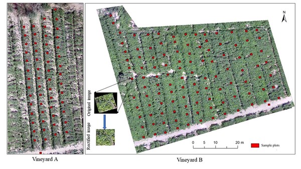
Fig. 1. Distribution of sample plots in two vineyards and rectifying a cropped image (in the middle).
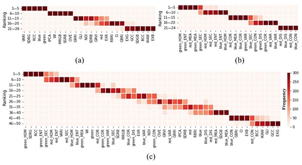
Fig. 2. Ranking of (a) spectral features, (b) textural features, and (c) combined features according to importance scores.
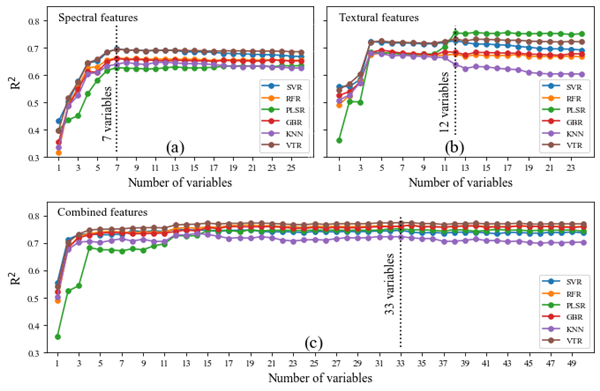
Fig. 3. Performance of shallow machine learning models with different numbers of (a) spectral features, (b) textural features, and (c) combined features.
Contact:
LIU Jie
State Key Laboratory of Desert and Oasis Ecology, Xinjiang Institute of Ecology and
Geography, Chinese Academy of Sciences
Phone: 0991-7885505
E-mail: liujie@ms.xjb.ac.cn