| Research Divisions |
 |
| Location: Home > Research > Research Divisions > Department of Space-to-ground Observation and System Simulation |
| Department of Space-to-ground Observation and System Simulation |
|
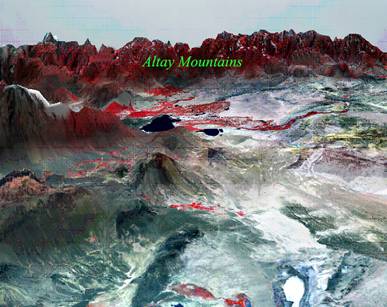
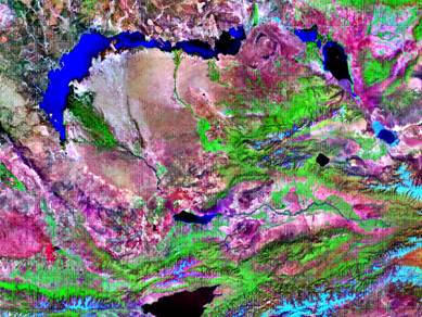
Research Fields (1) Long term monitoring and evaluation of the conditions of resources and environments in Central Asia (2) National and local security in terms of resources and environment (3) Hydrological processes at multiple scales and their uncertainty in arid inland river basins under climate change (4) Land use/cover change in arid areas under climate change and human activity (5) System simulation of ecosystem processes Significant Projects (1) The carbon cycle process in arid areas of the Asia-Europe inland and its global influence (supported by the National Basic Research Program of China (973), 5.68 million yuan, 2009-2013) (2) The application of technology for extraction and analysis of multi-sources information to show mines and identify potential mineralized areas (supported by the National Key Technology R&D Program, 2.6 million yuan, 2007-2010) (3) Demonstration of techniques of the adaptation of northwest ecologically fragile areas to climate change (supported by the National Key Technology R&D Program, 1.6 million yuan, 2008-2010) (4) Construction of a basin water resource management demonstration area, and ecosystem restoration in an arid area (supported by the UNDP, 1.20 million US dollar, 2008-2010) (5) Demonstration of the engineering and science and technology involved in transforming cultivated land to forest in a typical area of the Yili River Basin (supported by the Xinjiang Uygur autonomous region, 1.83 million yuan, 2006-2010) Major Achievements (1) Technology integration and application of remote sensing monitoring and information system for ecological security in Xinjiang Aiming at the major scientific problems of ecology and environment in implementation of the China West Development Strategy, the project developed 8 key technologies for monitoring, evaluating and managing the ecology and environment of the arid zone. The project integrated 3 application technology systems and platforms and built 4 typical operation application systems through integrating the theories and methods of multi-subjects, such as ecology, geography and environmental science. Moreover, the project made a breakthrough in the techniques for the fusing and intercross calibration of multi-source remote images, the index of magnanimity of spatial information, the multi-user operation of spatial databases, the remote sensing evaluation of oasis stability, the multi-scale tree-dimension auto-modeling, the visualization of virtual environments, and the remote sensing quantity evaluation of arid zone eco-assets. The project solved key technical problems in the area of remote sensing data collection, the data criteria, the spatial data integration, the real time tree-dimension modeling, the virtual realism, and data security. It made great contributions to promoting ecology and environment monitoring in arid zones, building a database of resources and the environment, and applying powerful techniques to national security and digitalizing rivers. The project gained second prize of the National Science and Technology Advancement Award in 2007. (2) Project of research and application of 1:1,000,000 scale digital elevation modeling in China The project succeeded in: a) Constructing a Xinjiang’s maturity relief database and remote image database b) Establishing the maturity classification and coding systems and the principles for the remote sensing interpretation techniques for Xinjiang digital elevation modeling c) Publishing the whole country standardized topography dictionary d) Constructing a database and share platform for the China digital elevation modeling, and accomplished a seamless mosaic e) Mapping a China digital elevation model at 1:1,000,000 scale f) Serving the national basic research programs and the local application projects g) The project gained the second prize of the National Science and Technology Advancement Award in 2009. (3) Water regulation system of the Tarim River Basin This system accomplished the unified regulation and management of the water resources of the Tarim River Basin in order to control and protect its eco-environment. It constructed an information collection system (that united remote survey, remote control, and remote sensing), the data transfer system (involving fiber optic cable, microwave, and satellite), the data processing system (integrating simulation, virtual realism, optimization), and the real time management system (combining meeting allocation quotas and electron government affair). This system is now operating in the Bureau of the Tarim River Basin. Main publication Liu H L, Chen X, Bao A M, et al. 2007. Investigation of groundwater response to overland flow and topography using a coupled MIKE SHE/MIKE 11 modeling system for an arid watershed. Journal of Hydrology, 347(3-4): 448-459. Software registered by the National Patent Bureau a) Analysis system for the demand water of the ecological environment in arid basins(2009SR039294) b) Management analysis system of the ecological section of a typical arid basin (2009SR052764) c) The risk evaluation system of the soil salinization of the mainstream zone of Tarim River (2009SR052763) d) Simulation system for the GSVAC water and heat transfer in the Tarim River Basin (2008SR17244) e) Three dimensional navigation system of the Tarim River (2007SR17755)
GIS management of water resources in drainage basin
Water resources utilization in trans-drainage basin
Visual simulation of large rivers in Xinjiang Personnel There are 35 research staffs in the department, including 9 professors, 10 associate professors, 3 scientists of the Hundred Talents Program and 17 visiting professors. Contact Tel: +86-991-7885378, 7885374 Director: Prof. BAO Anming E-mail: baoam@ms.xjb.ac.cn Deputy Director: Prof. YANG Liao E-mail: yangliao@ms.xjb.ac.cn
|

| Back |